There is a remarkable story behind the upkeep of many of the central Westland huts. As part of a 2006 DOC review, a large number of the lesser-used huts were set for removal due to their low patronage and high costs on paper due to bookkeeping procedures. This lead to the formation of Permolat, a charity which has spent the past 20 years reinstating tracks and upkeeping huts that DOC has largely abandoned.
Two of these huts are Rocky Creek Biv and Griffin Creek Hut. They're actually two of the more accessible huts from Darfield, located near the Taipo catchment which itself is near Aickens Corner for those more familiar with the Coast to Coast. As I've been working through the hut list, these two stood out as an easyish overnighter with an acceptable drive time and minor road walk to link the two.
I'd somewhat had a crack at the loop before, heading over to the Taipo with a clearing forecast. It was not to be though, with the West Coast rain still pouring down and I made the decision at the carpark to not risk the river travel. I did take the opportunity to cut out the windfall between the roadend and Rocky Creek, of which there was a moderate amount.
Back to the present day, I headed over on the Saturday morning with higher hopes and hopefully higher sunshine hours. I parked up at the carpark on the true left of the lower Taipo, which is mercifully hidden from SH6 - the carpark on the true right has a reputation for frequent break ins. I set off in earnest, with "at least 8" Permolat hours ahead of me.
The route begins with a short section in scattered bush with a stream crossing an athletic soul might jump. Shortly after, it switches to travel through a grass clearing, the main barrier being the wild blackberry bushes on the fringes. There is little marking here, but following the lie of the land takes you to a short bush section and then back onto the banks of the Taipo. The river has a reputation for difficult crossings, though today it was following low and clear.

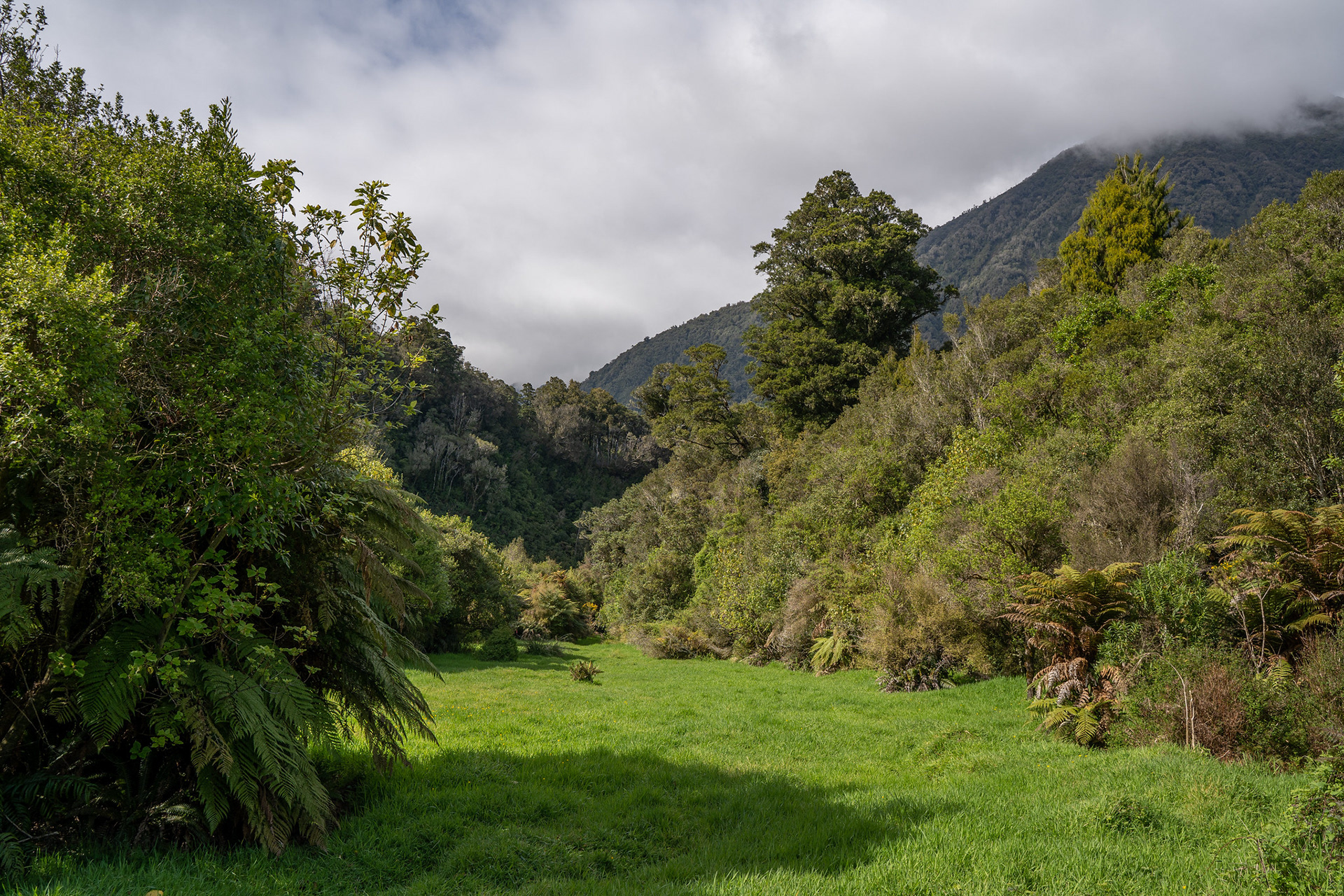
A pleasant grass strip amongst the lowland forest.

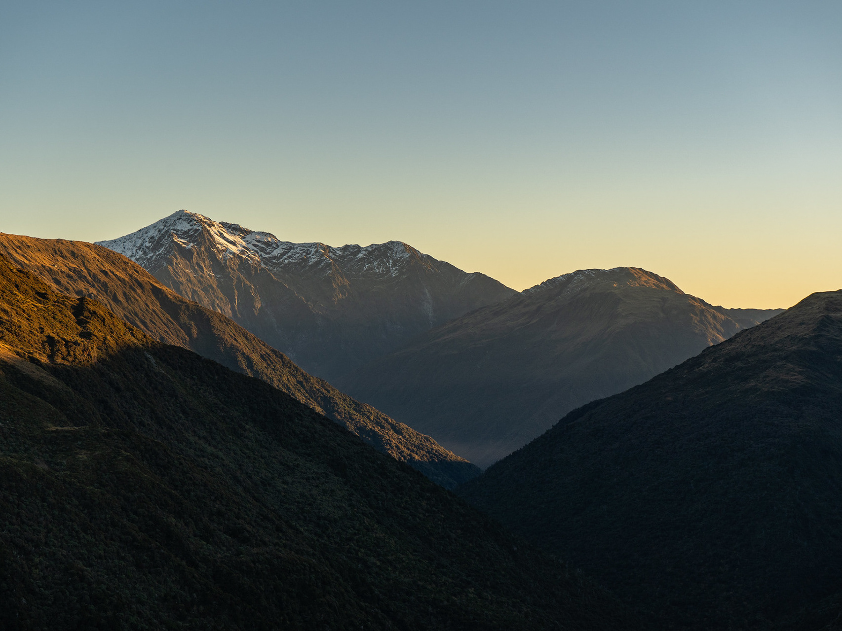
A short section of riverbed travel alongside the beautiful Taipo River, the toe of the Bald Range behind.

The route leaves the riverbed on the true right of an unnamed stream. There is some marking here and it's a short steep few moments to get off the valley floor, but the trackline can be easily followed by handlining off the spur crest. It climbs a few hundred metres to clear a large slip, before veering left onto the high terraces at around 300m. There are smatterings of views into the mid-Taipo and Kelly Range.

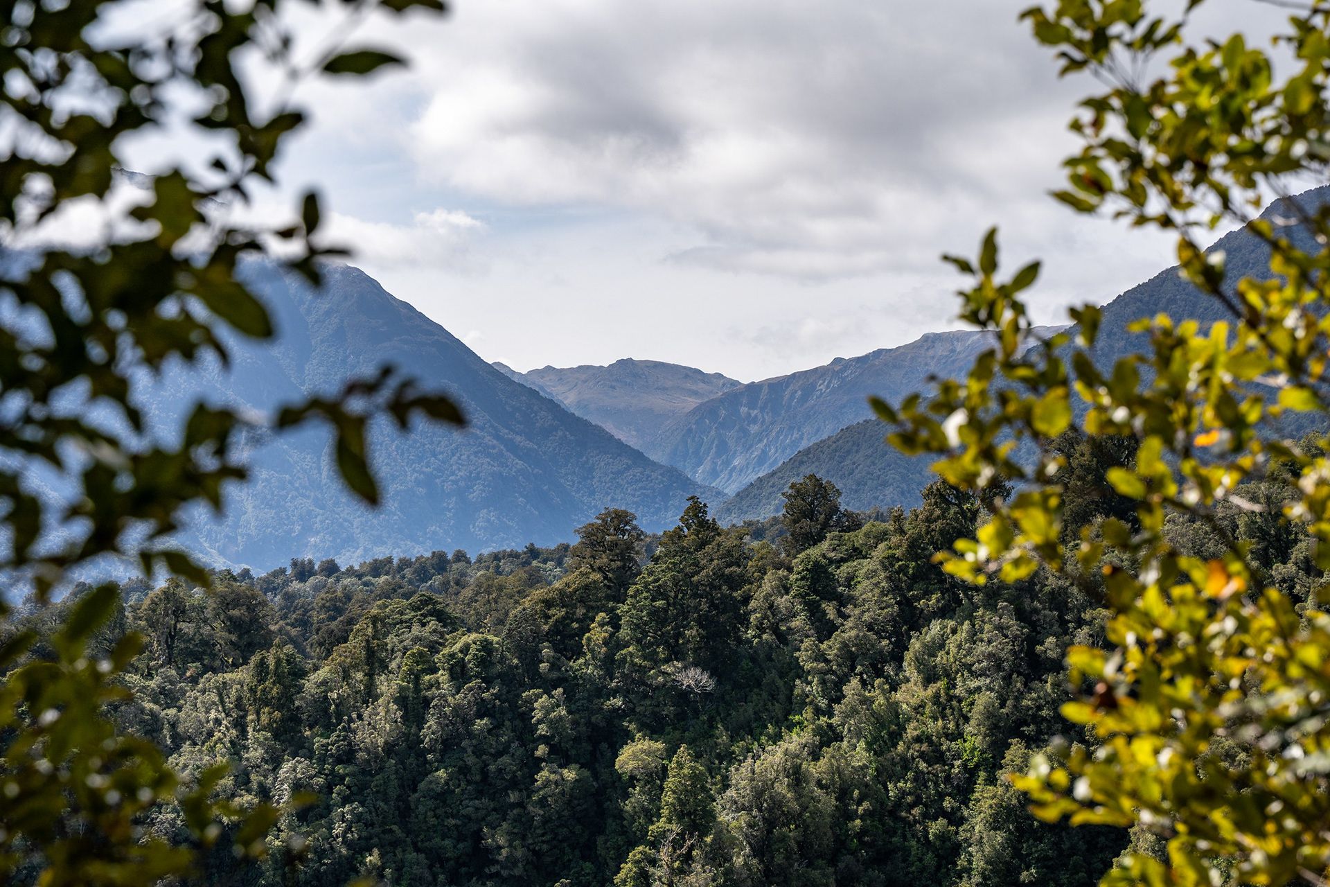
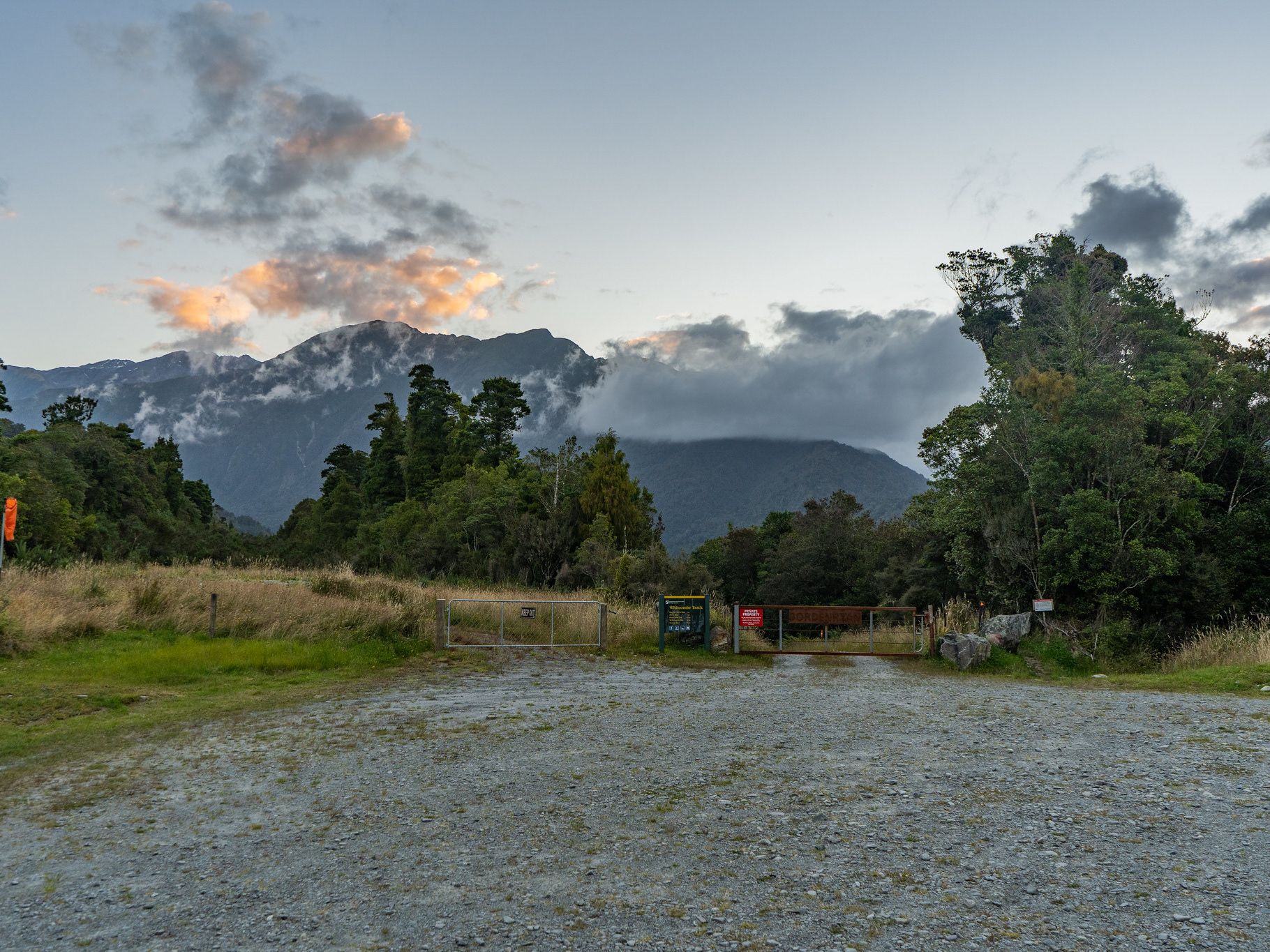
Up towards the Kelly Range, there is good access into the mid-reaches of the valley either along the true right or via Carroll Hut.

The terrace travel is reasonably straightforward. At the time of writing, there wasn't a massive amount of marking but the route is well cleared. The track was historically upkept by Frank King and Honora Renwick (thanks!), though it's one that has been adopted by others sporadically due to its accessibility and proximity to population centres. It does get damaged - when I'd come through a few months prior doing windfall clearance, I'd spent about 15 minutes trying to refind the trackline where a large slip had swept the visible markings down the face. Unfortunately, the original trackline must have swung hard uphill at that point, because I eventually found it by a marginal scramble up the slip edge - I did note that someone had snigged a short section of track to reconnect it for my second trip through.

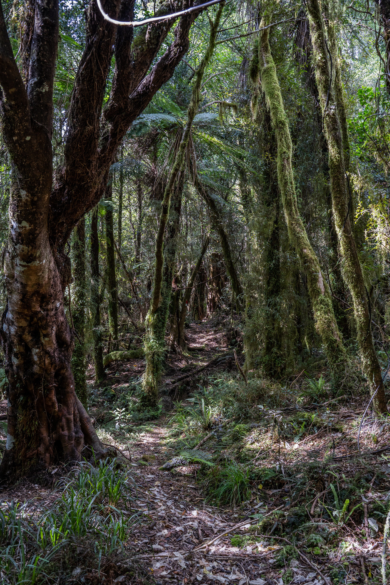
Some sections of the track are delightful.

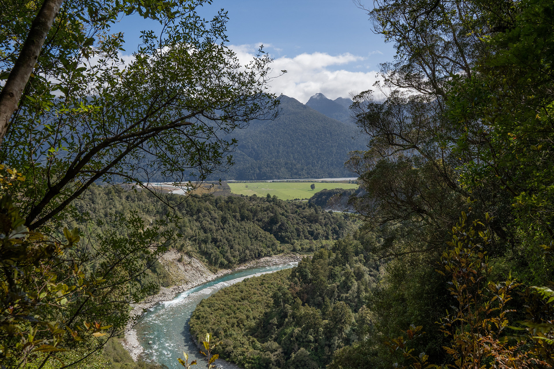
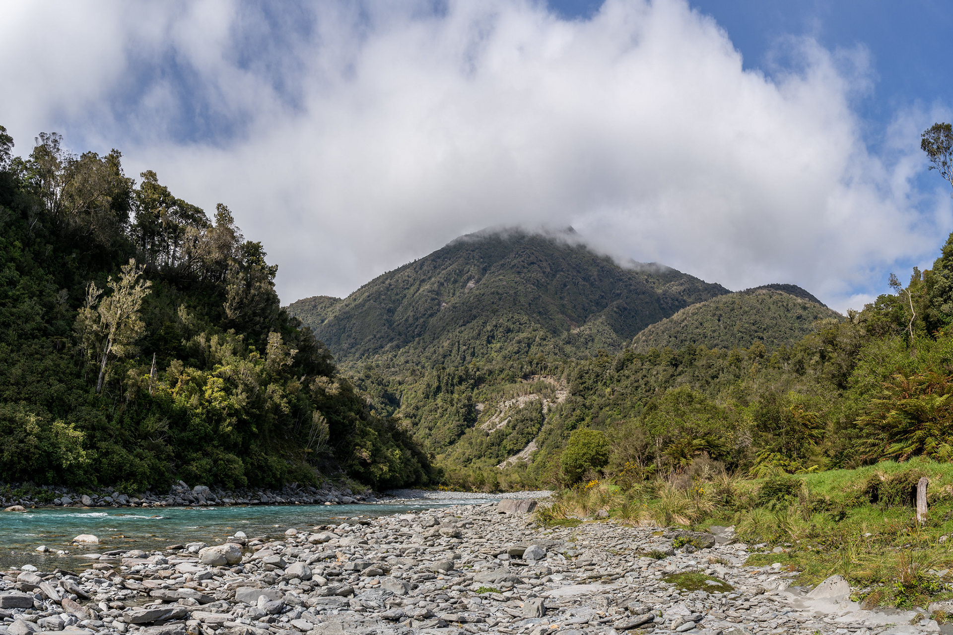
A fleeting view of the bend in the Taipo River.

Around an hour after heading out, the terrace lip is reached where Rocky Creek has abraded a bit of a gut. The track becomes a bit indistinct here, the first time I came through I found a good line right down and the second time it was a bit of a bash. There is also a tracked section which heads uphill and possibly offers the ability to avoid some of the lower travel in Rocky Creek itself. It's fortunately quite a short bit of travel, and even if you cannot get the exact trackline (I certainly didn't!), you can just descend until you head the creek bed and set off upstream.

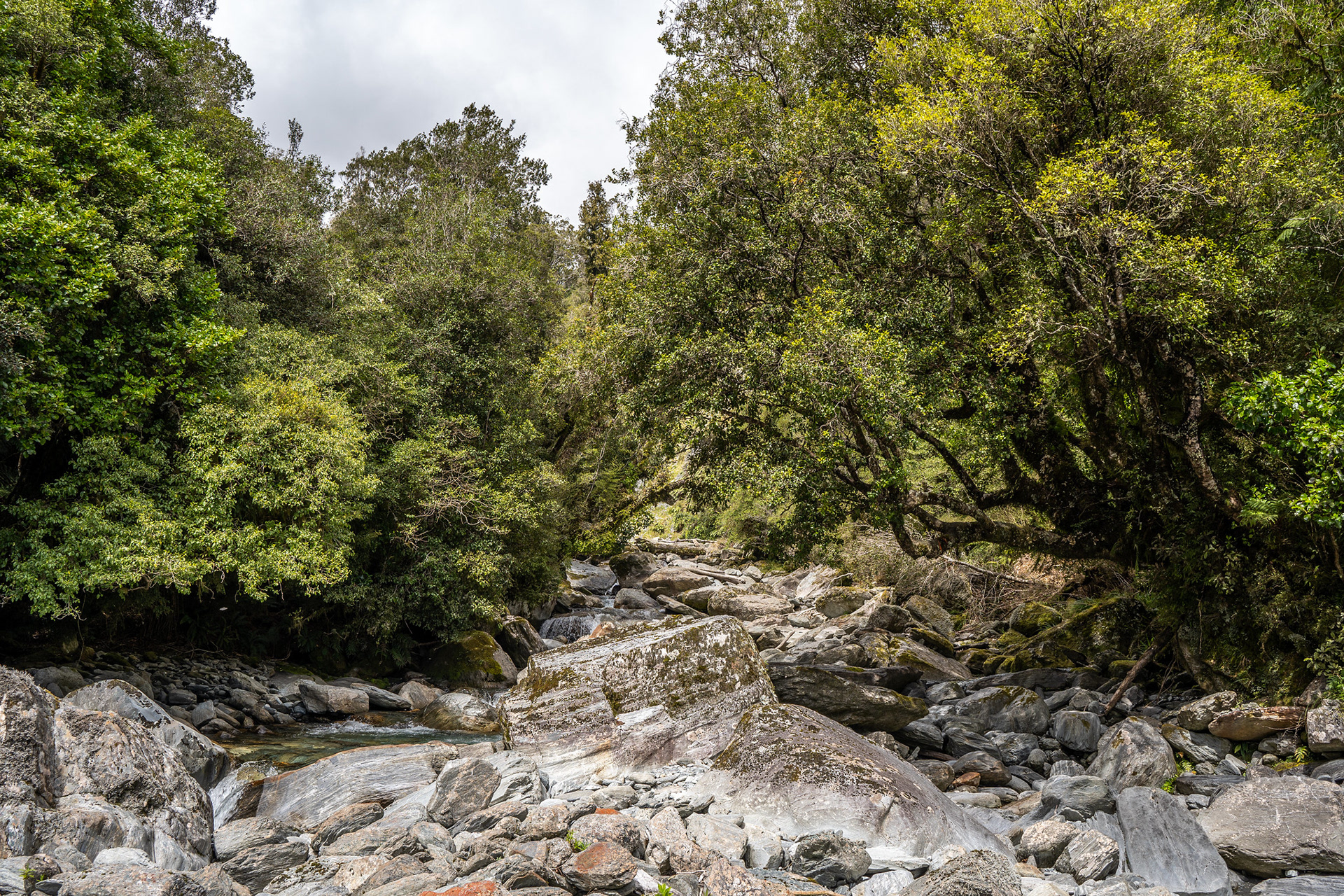
This is where the track hits Rocky Creek, this moderate boulder hopping is typical for the next few hours.

Travel upriver is reasonably good, though the Permolat website mentions that since my visit, Eigill Wahlberg has recut the sidle tracks on the true left which means little river travel is now required. In some ways, it might seem unfortunate that I went through and did the circuit in the years prior to major trackwork and biv renovations - it was certainly harder than what it would be now. That being said, one also has to reflect on how fortunate we are to have people like Eigill and Andrew Buglass (who spearheads the charity) doing this work, making life better for those who are yet to experience the beauty of these areas. I do try to trim tracks as I go, which is broadly what these volunteer groups preach - it only takes a little trimming from each user, and the tracks will remain viable as a going concern.
I made it up to Rocky Creek Biv in a couple of hours. There is one small waterfall (more of a cascade) in the river which can be bypassed using a short track on the true left and then a traverse across a damp rock bench, plus even in 2022 the old sidle tracks were mostly viable. If you are using the GPX file at the bottom of this post, it's important to keep in mind that it's simply the lines that I took - feel free to navigate as best suits on the day. Also note that it's not a wildly accurate GPX trace, as valley travels generally aren't - this was compounded by being mapped off a cheap phone.

Probably the crux of the river travel, there is a viable bench on the right or a tall person might be able to mantle up the left.

Rocky Creek Biv is a 2 bunk structure. It's not a particularly appealing place to stay - little views, no toilet or fireplace, moldy mattresses in 2022. It must be highlighted that it has since been renovated, so probably a bit nicer now. If you are doing the whole Rocky / Griffin circuit, it's easily viable to get to Griffin Creek Hut in one day and that is the better option for most. Actually locating Rocky Creek Biv used to be a bit of a lottery too, with limited track marking and the wrong dry creek branch marked with cairns at one point. Conversely, the takeoff point from the main creek was marked with dozens of cairns in 2022 reminiscent of the 'rock art' at Fantail Falls near Haast. Hopefully this is all a bit cleared with the additional trackwork and biv renovations.

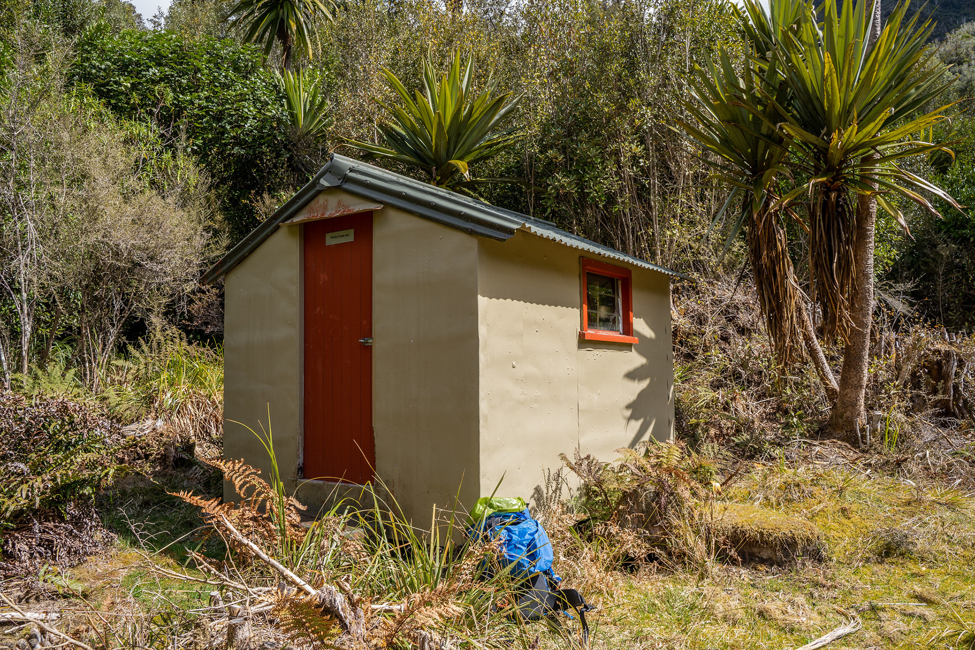
Rocky Creek Biv in 2022, it has since been renovated.

There's a short section of travel which cuts through a slightly exposed bank sidle back down to the creek, and then it used to be mostly river travel again most of the way to the saddle. I don't know how this section looks post-trackcutting, but the Permolat (RemoteHuts) website will have up to date information. When I came through, I had in turn stolen the GPX file off the Christchurch Tramping Club (CTC) website to guide me, the circle of life I guess! I was grateful, as the track was not wildly obvious.
As you approach the saddle, there is a large slip on the true left which has limited revegetation. The flagged track goes up and then down this slip, but it's probably just as easy to sidle the toe of it. Soon after, it takes off uphill towards the saddle. This section was quite overgrown in 2022, but has apparently since been recut.

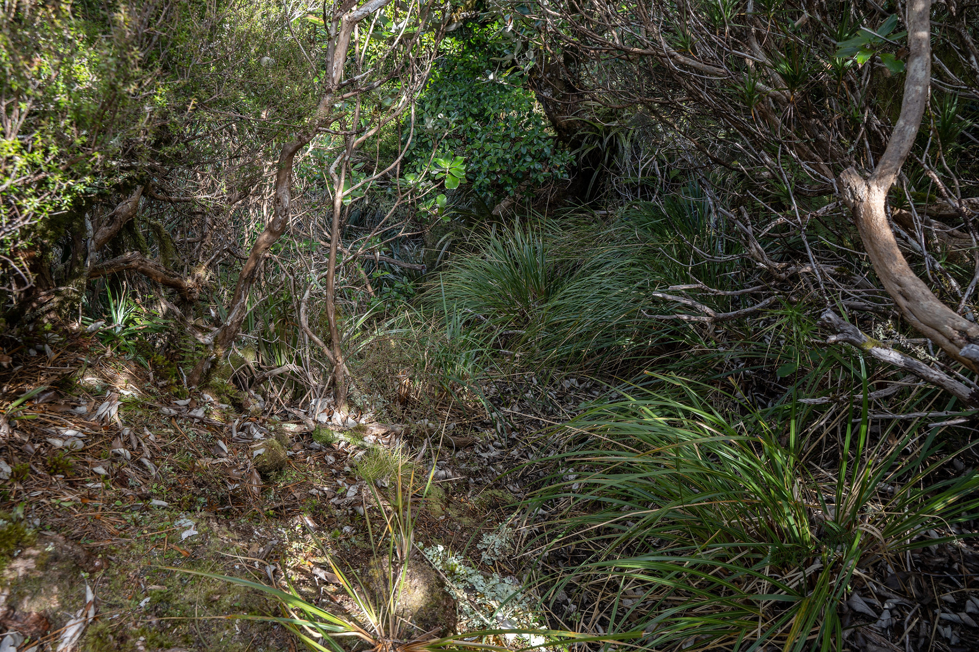
The track up to the Rocky / Griffin saddle as it looked in 2022.

Passing through the saddle, the trackwork became much clearer. I believe Geoff Spearpoint / Nina Dickerhof / James Thornton did some recutting on this side (as always, thanks!) in the years prior, but it's largely easy travel utilising mostly creekbeds with occasional linkage tracks to avoid difficulties. Towards the valley floor, the cut track swings left and meanders for a kilometre or so to Griffin Creek Hut. The hut is visible from a few hundred metres away, perched on a lovely platform with Razorback Ridge backdropping it.

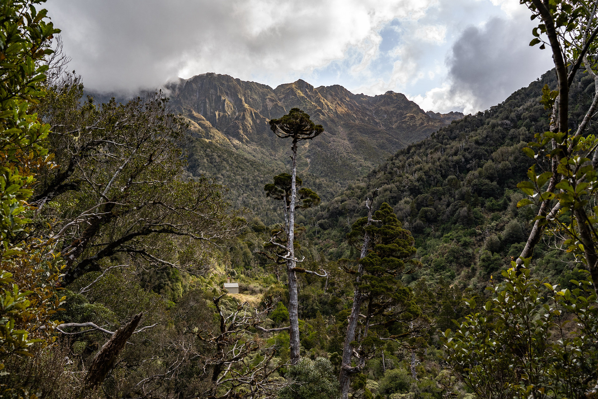
Approaching Griffin Creek Hut in the afternoon light.

I reached Griffin Creek Hut around 7h after setting out, one of the rare times I've materially beaten the Permolat timings. I think a lot of that comes down to how much gear I'm carrying, historically I've been an 'everything but the kitchen sink' type guy but have been whittling that level of conservatism down. I'm never going to be an ultralight tramper because of the camera gear I carry, but things like transitioning from the 2.4kg Macpac Minaret to an 800g ultralight tent as emergency shelter makes the world of difference.
Griffin Creek Hut is gorgeous! It feels snug, enclosed by the valley yet has an air of expansiveness with the views out. It sleeps four, has a toilet and a short track takes you down to the serene Griffin Creek. Truly a destination that is worth the journey from whichever direction you come.

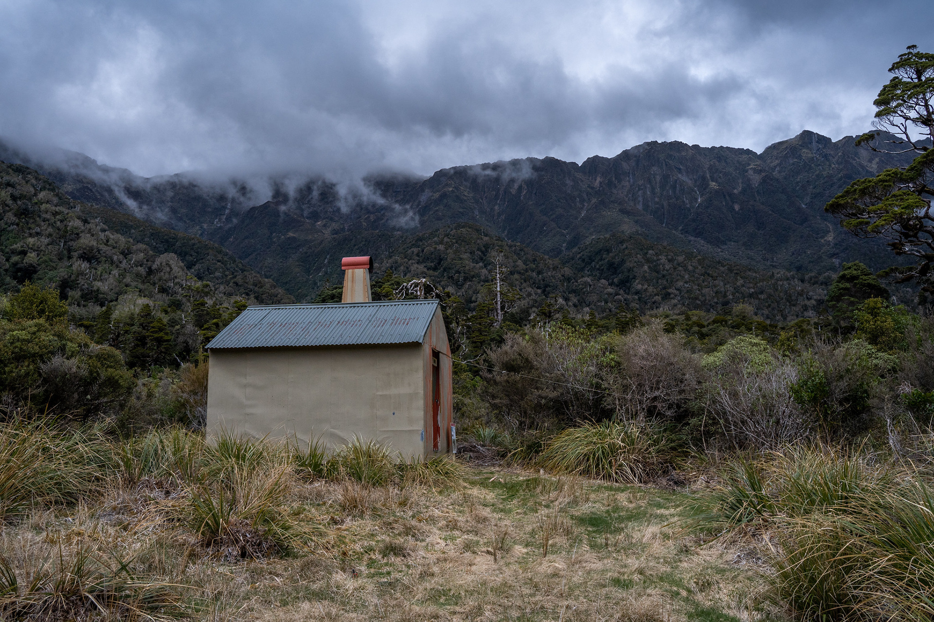
Griffin Creek Hut in its little clearing.

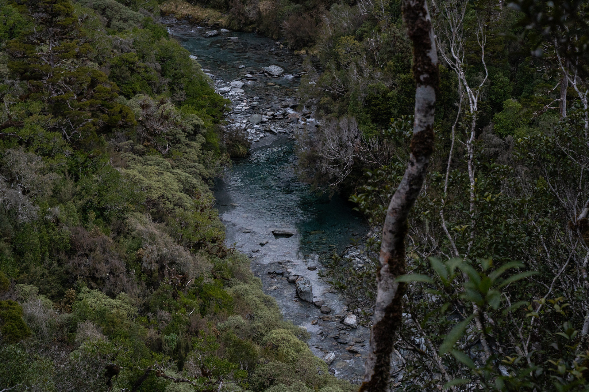
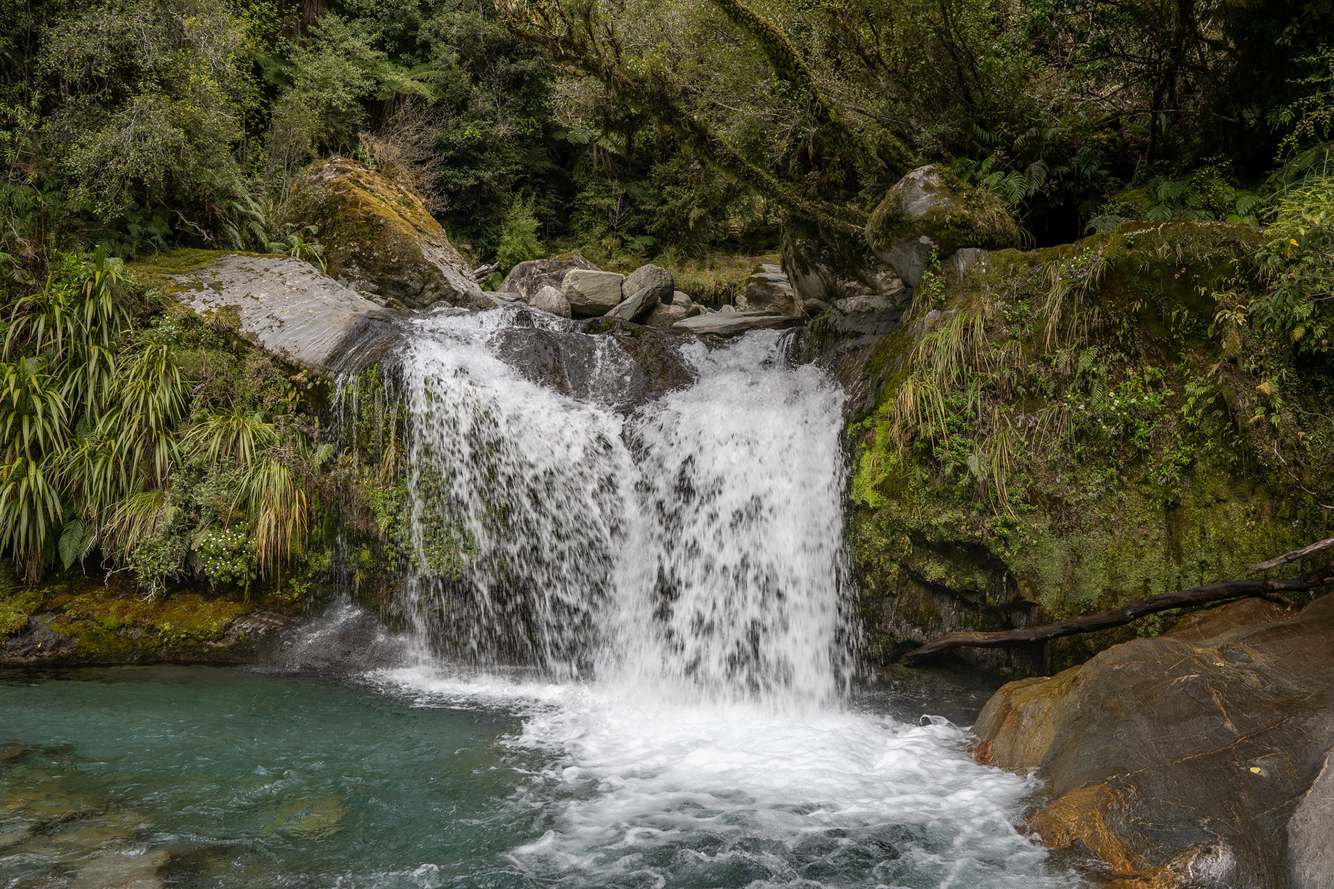
Griffin Creek itself, with its gorgeous deep emerald hue.

Despite its idyllic setting, the hutbook does have quite a few tales of worry and woe from those caught in the rain. There was one recent entry from a party that could not get across Griffin Creek and set off their PLB, reasoning that it would result in an efficient extraction rather than triggering a full LandSAR response when they became significantly overdue. There is no easy way to escape if the rivers high, as both Rocky and Griffin Creeks need to be forded for the normal approaches. It would be possible to escape via Mt McInerney, probably descending its eastern ridge to pick up the terrace track. That would be a potentially long day, but one I started to look into carefully as the weather closed in and it started to drizzle. My InReach suggested it wouldn't amount to much, and fortunately it was right with its insights.
After a night of stargazing and restful sleep, I woke the following morning for the journey out. After retracing the last of yesterday's journey to the junction, I dropped into Griffin Creek for the next few hours. It was mercifully crossable, but it's still quite a sizeable waterway and would easily become impassable. You also cannot just take the true right all the way down, due to it exiting via a rather involved gorge. This canyon is widely considered one of NZ's best, but also one that requires 2 x 60m ropes and various other gear one would not normally carry on a tramping trip of this nature.

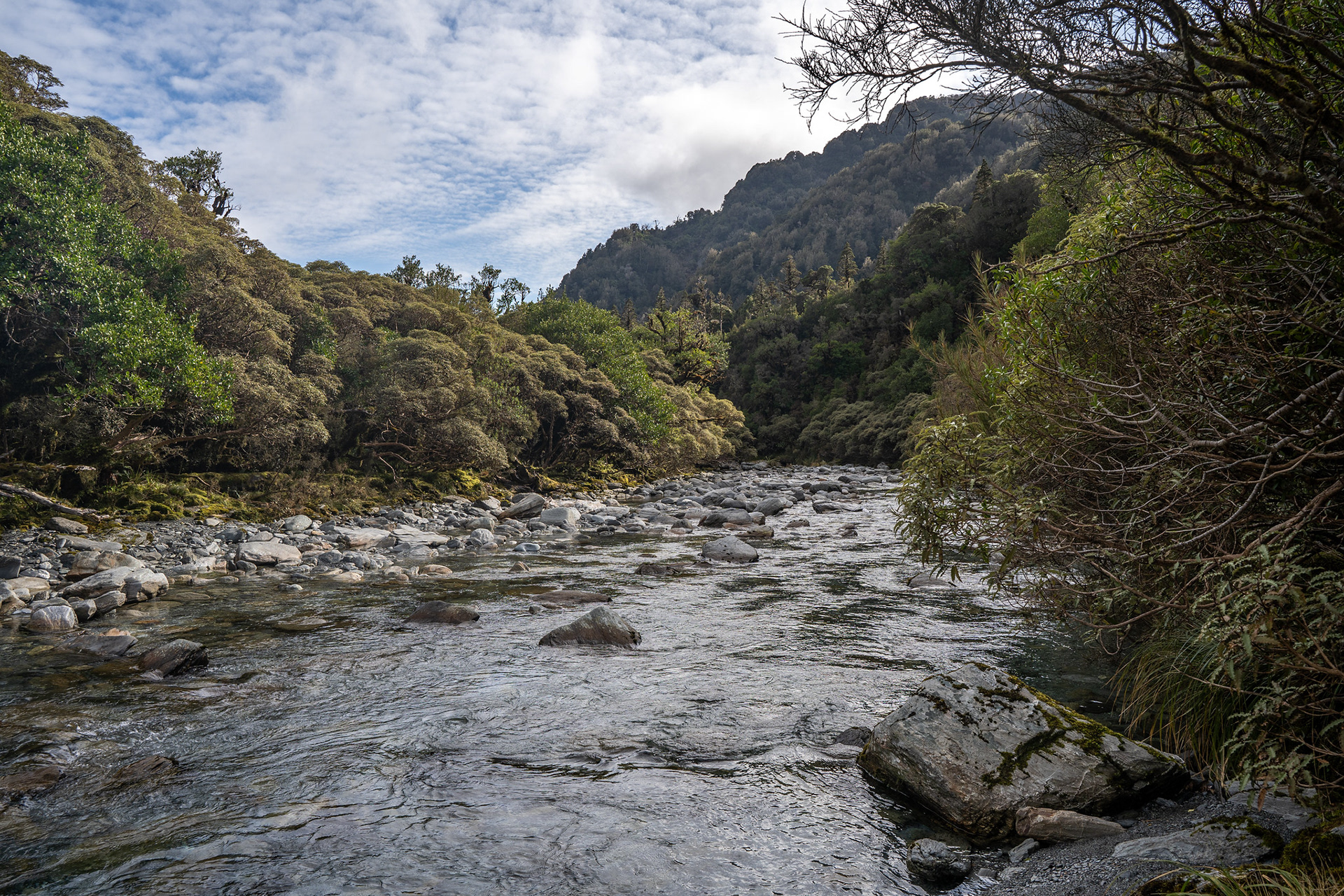
The upper reaches of Griffin Creek, this is low to normal flow - would be a hard crossing after rain.

There is a small gorge midway through the upper reaches, which has a short sidle track on the true right. There were also whio / blue ducks present when I passed through, quite the treat!

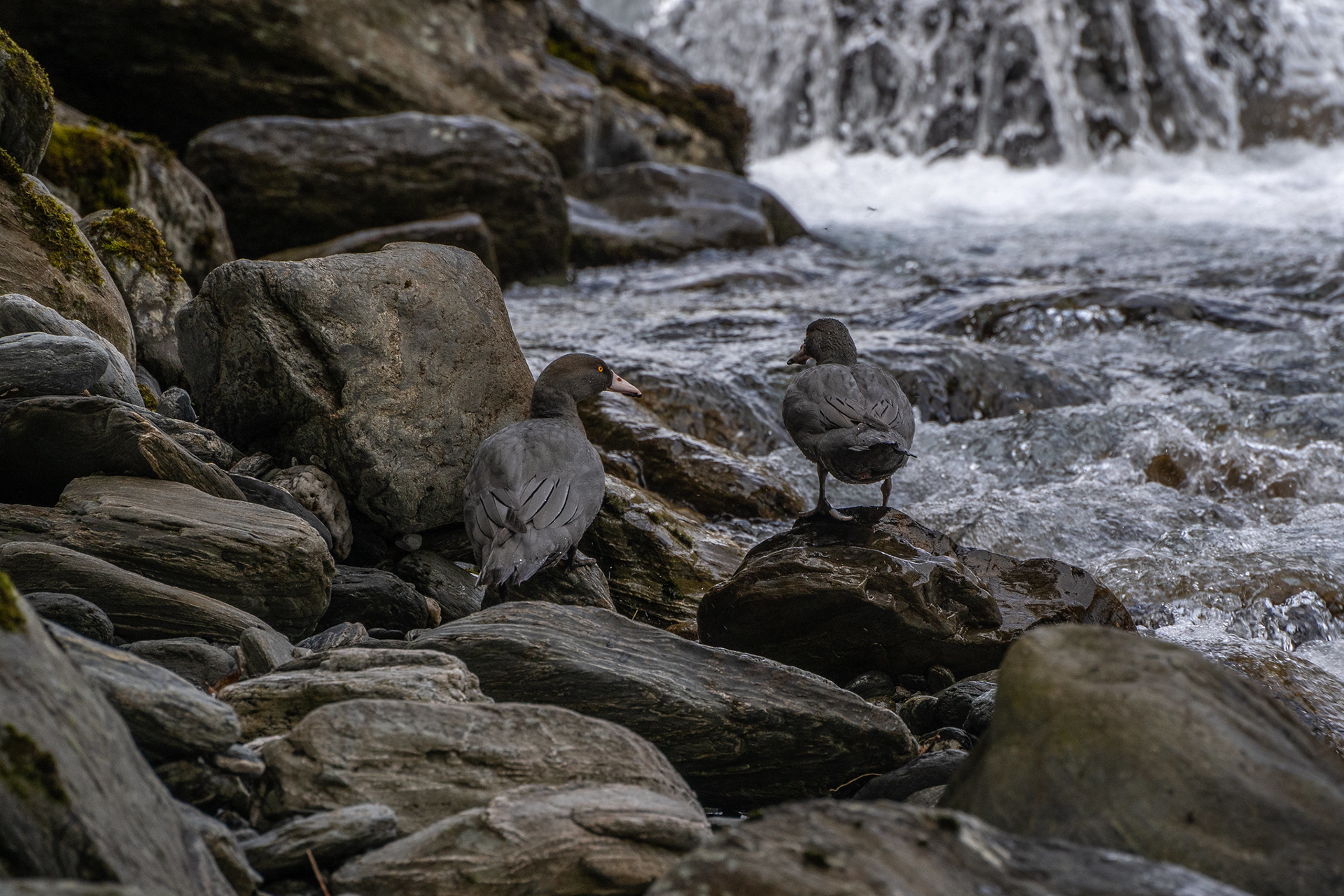
Whio / blue ducks in a small gorge in Griffin Creek.

There are some beautiful pools as you progress downriver, and smatterings of river flats. If the river is marginal, you would get away with just a couple of crossings but if the flows are easy, going back and forth will give you easier travel.

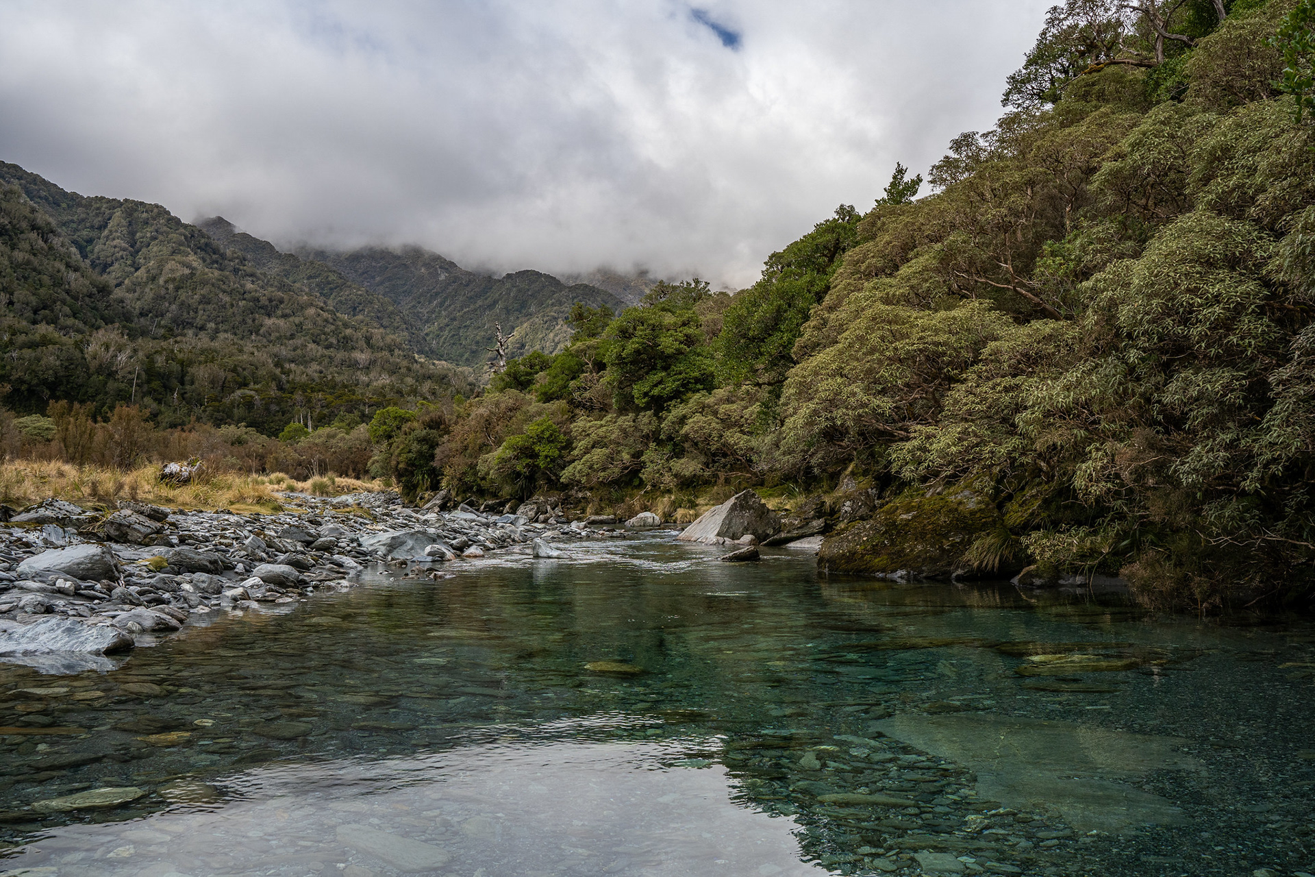
One of the lovely still pools in Griffin Creek, near where the track to pt. 974 takes off.

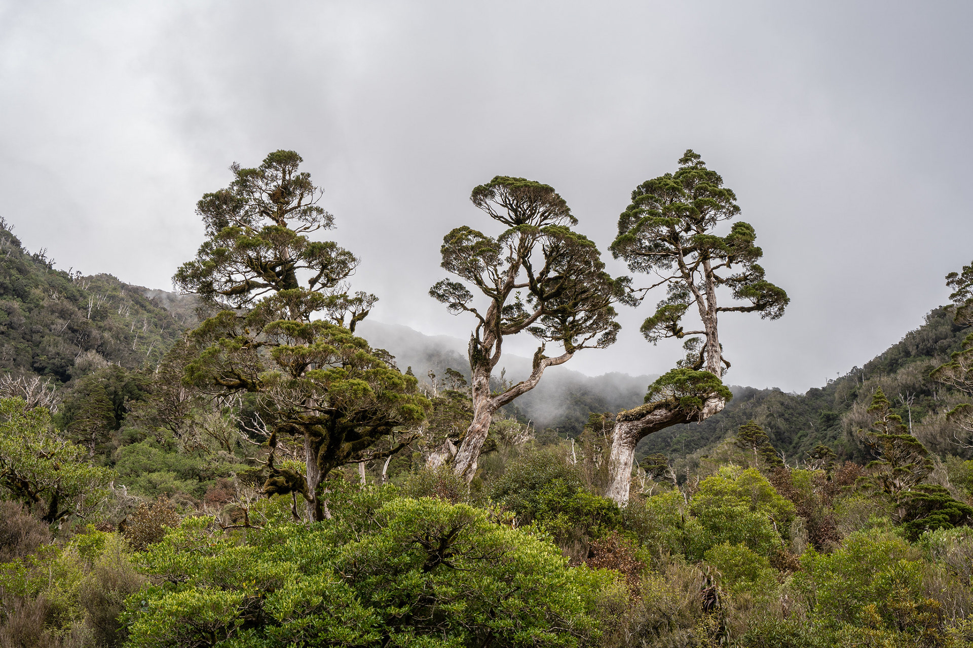
These are apparently mountain cedar (Libocedrus bidwillii / pahautea). I learned two things from the hutbook at Griffin Creek - these apparently do not burn, and also that the hut's woodshed was full of it.

At one point when heading downriver, you'll likely cross to the true left to gain some flats which look like tussock on the topo map but are actually a little scrubby. From here, it's a short distance to the next section of track which climbs up to pt. 974. The entrance is obvious and the climb well marked, albeit quite steep. There are nice views back over the middle reaches of Griffin Creek on the ascent, and I was blessed with a visit from a friendly kea. We tend to associate these birds with the open tops, though they inhabit a range of altitudes - humans are probably just easier to find and investigate without the forest coverings.

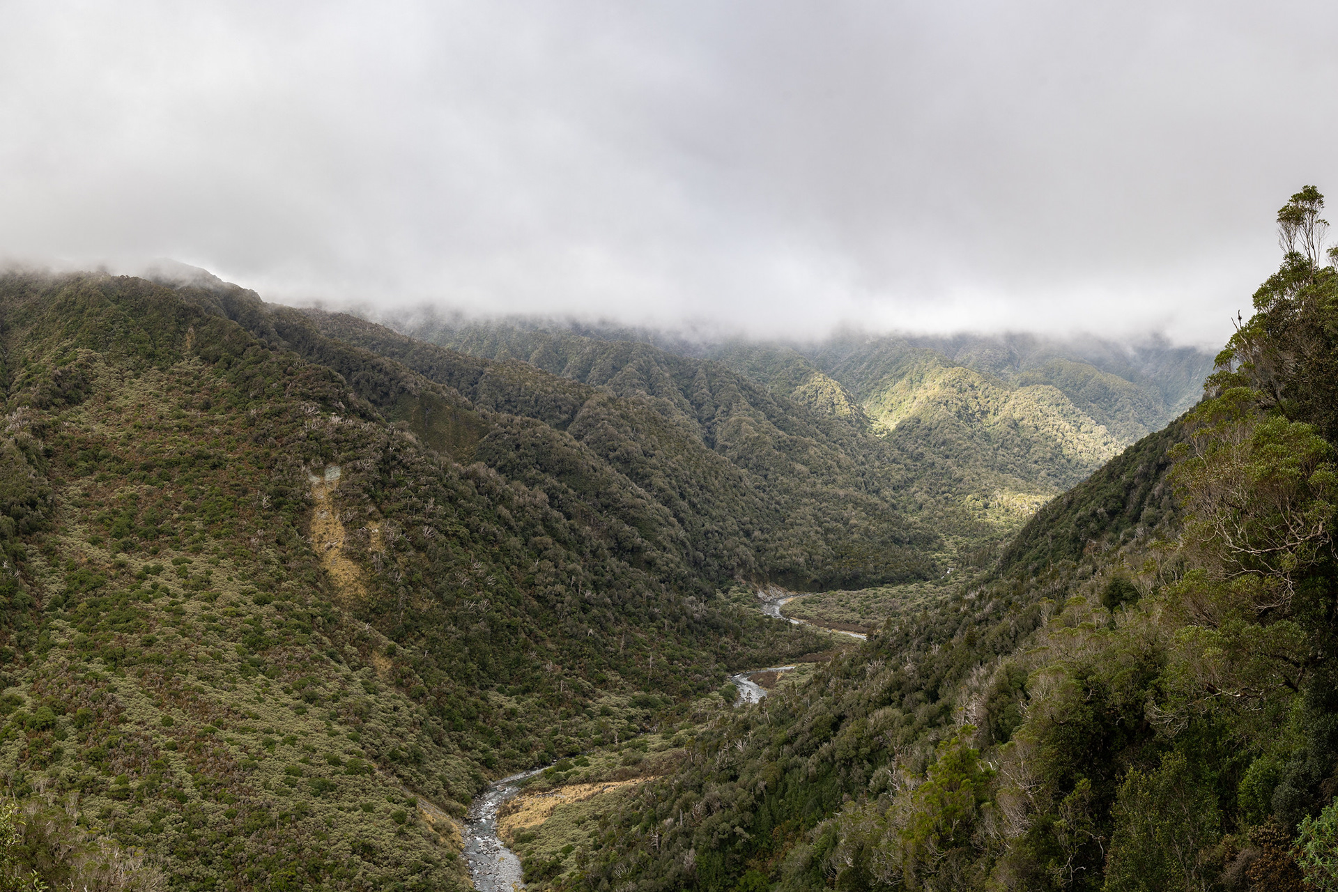
Looking back down into Griffin Creek, with its serpentine like appearance.

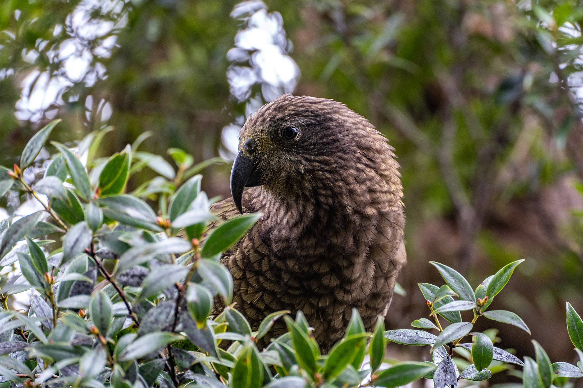
An inquisitive kea having a nosey.

At pt. 974, a track runs up towards Wilsons Knob but I took a right and headed down. It's a good track down, there were a couple of minor windfalls in 2022 but the locals who upkeep it do a sterling job. I was grateful to be descending it though, as its otherwise a circa. 900m climb in the other direction!
As the terrain levels, the route briefly drops into Harrington Creek and eventually finds its way to the pastoral margins. You can follow the outside of the fenceline down towards the highway, before gaining an old part of the highway (which has legal public access) and following that out to the modern SH6. It's about 3km of roadwalking with minimal shoulder back to the Taipo, a small price to pay to close out a delightful overnight loop. 

You may also like

Back to Top