Mt Taranaki is a peak of great prominence, in many ways than one. It's probably one of New Zealand's top 3 most photographed mountains, along with Aoraki / Mt Cook and Mitre Peak down in Milford. Rising out of plains scarcely at sea level and shooting up to 2518m, it's also an incredibly pronounced landmark and a sight of great beauty.
Standing so far distinct from other conservation areas, Taranaki is also a peak that tends to attract climbing lifers. I used to be one of those when I lived in the region, and it's understandable - I could drive to Dawson Falls, get up and down the peak and be home in time for lunch. Compare that to the 3h drive just to get to Tongariro, and it's apparent why some locals have climbed the peak over a thousand times. I'm not that committed having been on top maybe 50 or 60 times, though I have done most of the ~20 different summit routes across all four seasons.
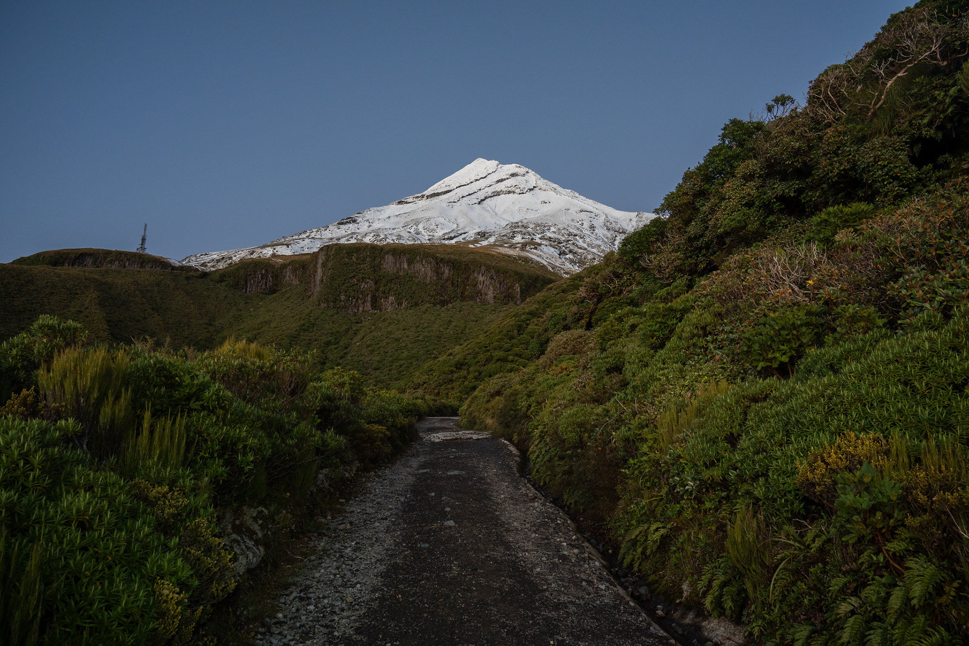
I no longer live in Taranaki, and it's a bit much to drive the 3h up for a day trip. We happened to be heading to New Plymouth for a catchup over ANZAC weekend though, and by some good fortune the Saturday was forecast to be smashing. I was somewhat hoping it would be free of snow to speed up the climb, though it unexpectedly turned out the opposite with excellent snow coverage right down to Tahurangi Lodge at 1500m. It ended up being quite lovely in that sense, peaceful up top and the opportunity to simply slap on crampons outside the lodge and leave them on until I returned.
Taranaki in winter isn't a technical prospect for climbers, but it is treacherous. It sees similar numbers of fatalities to Aoraki / Mt Cook, largely due to people slipping on its unforgiving ice and falling over bluff lines near the base of North Ridge - Hongis Bluff to the south, the Waiwhakaiho Bluffs to the north. Snowpack conditions do vary, but rime is a frequent issue especially on the upper slopes and sometimes the lower flanks have boilerplate ice with no real prospect of arresting a fall.
I had fortunately brought some alpine gear, an ice axe and some strap (i.e. C1) crampons with my regular tramping boots. I meant to bring a helmet too, but having dug mine out it became apparent that the webbing and padding was well degraded so I left it behind. Poor form for sure, and something I managed to regret soonafter entering the snowline - I was still expecting to largely be on scree as the mountain was almost bare before the recent front, and it was yet to clear enough to get a coverage perspective from the webcams.
I was supposed to be at the airport slightly before midday to collect a friend, but I didn't leave the New Plymouth accommodation until around 5:45am which meant a 6:30am departure from North Taranaki Visitor Centre (formerly North Egmont Visitor Centre). I was going in a bit blind regarding fitness, I'd done some mid-week trail running but no tramping since Travers-Sabine in late February. The last time I'd done more than 1000m of climbing in a day was Christmas, four months prior.
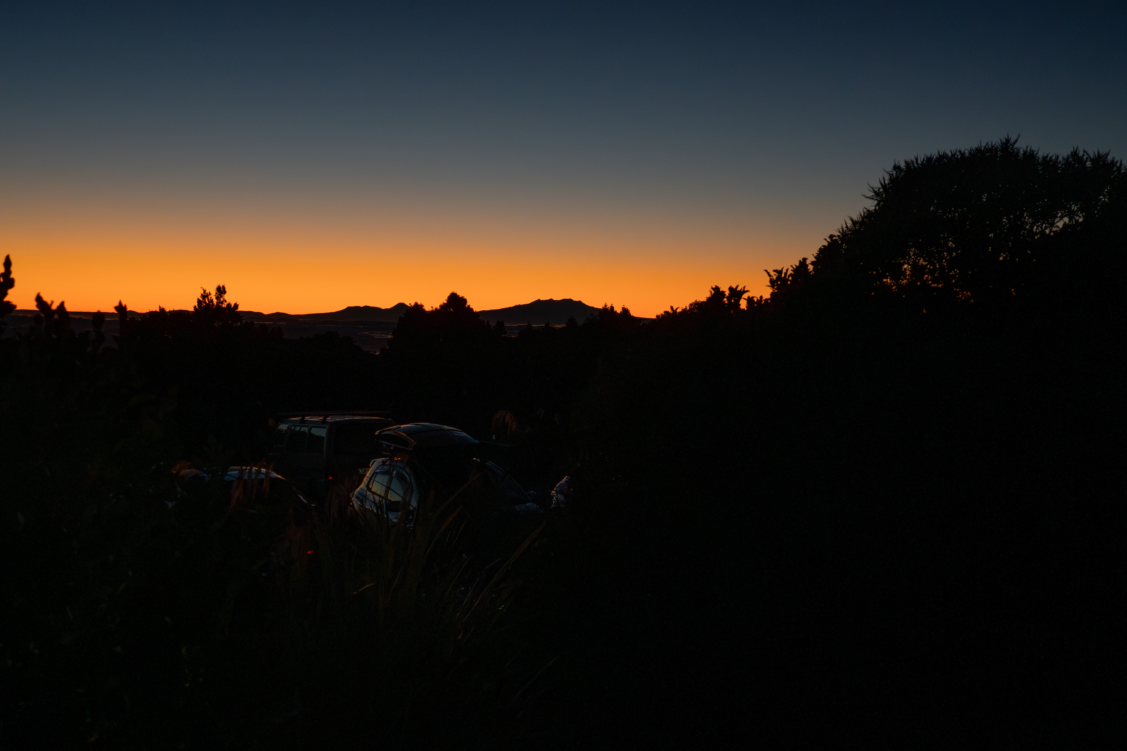
At the carpark, I got to reminisce in the beautiful rich pre-sunset hues to the east with the Tongariro peaks silhouetted. I had enough dawn light to vaguely see Taranaki itself, which indeed looked quite snowy. With no real time to waste, I locked the car and wandered upwards, briefly passing a group of people outside The Camphouse (DOC accommodation) awaiting the sunrise.

I managed to not miss the initial junction and went left onto Translator Road, the 4WD track which services the transmission architecture at Tahurangi Lodge. Taranaki is a bit funny like that, it's almost 1600m between the carpark and summit but the first 600m of that is essentially on road. The lower travel is easy, though occasionally oscillates up and down to find agreeable lines through gullies. It's also largely bounded by low scrub which allows delightful views.
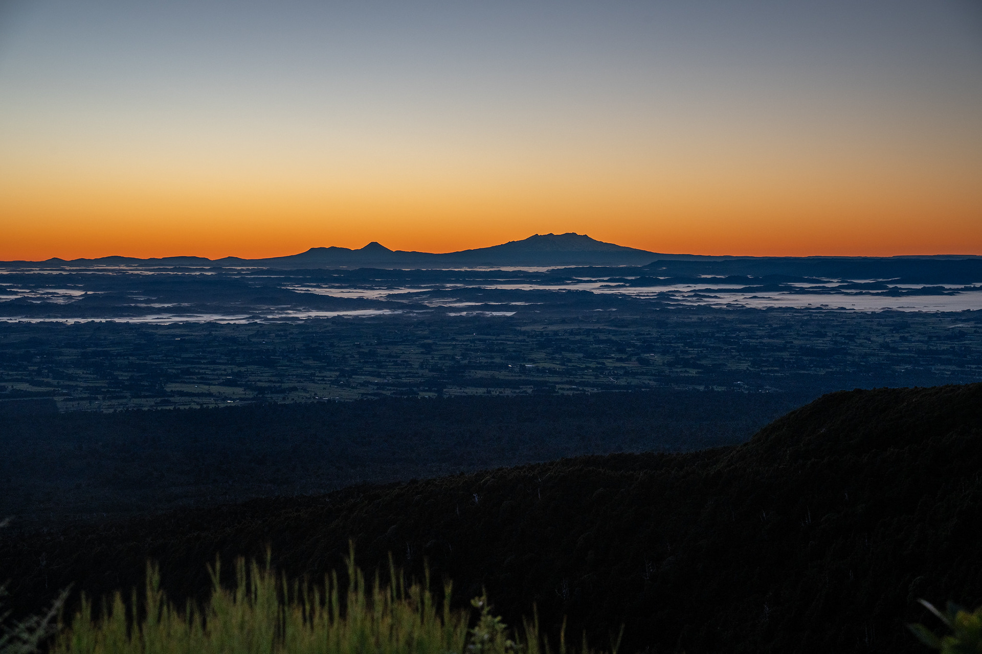
It does eventually hit the cobblestoned section of road known as The Puffer, which climbs more steeply. From the base, I enjoyed a glorious sunrise across towards Ruapehu hundreds of kilometres away.
At the top of The Puffer, I encountered Tahurangi Lodge and a smattering of others. I vaguely recalled that I used to reach the lodge in around 45 minutes when I was young and fit, so was content to see my watch read a little under 50 minutes. There was already snow around and the gully ahead ('Hongis Gully', the upper reaches of the Maketawa) looked infilled, so I took the chance to put crampons on for the first time in years and set on up. I managed to almost immediately trip on the ice axe leash, so perhaps getting a bit rusty with age.
The lower reaches of the gully were fine, but the trackline migrates to the true left and goes up stairs which run hard against the andesite bluffs that border the valley. Unfortunately, the blufflines were absolutely plastered with rime that was rapidly shedding with the first fine day in a while. Even worse, the bluffs had shadowed the trail leaving it as bulletproof ice, a diabolical reintroduction to the peak.
Rime is deceptively dangerous, especially when it falls. It forms when the supercooled and moisture laden marine air impacts the peak and quickly aggregates on pronounced ridges, cliffs and outcrops. It quickly loses cohesion in higher temperatures and sheds in frequently large accretions, dropping dinner-plate sized blocks which hopefully shattered into less destructive shards as they drain down the peak's faces and valleys. Being so close to the source means they're often dropping almost whole, I did take one unfortunate impact to the arm but otherwise scampered through unscathed.
Clearing the confined section of valley unfortunately did not cease the hazards. The summer route climbs wooden stairs onto the scree of the lower North Ridge, but I just found horrendous hard ice overtopping the stairs. There were faces available on both sides, but there was hard riming on the rocks above which promised further difficulties. It would be a really bad place to fall, as the cliffs below are encountered immediately.
Despite knowing the peak reasonably well, I'd never really found myself in this specific situation before. Early season is often the worst time to climb as the snow coverage can be irregular and icy, and I'd historically mostly climbed from the south (closer to where I lived) or accessed North Ridge via the Around the Mountain Track (which relies on more snow coverage to avoid damaging the alpine vegetation). Another popular route called Surrey Road is available back to the south, but it would have meant a downclimb back to the lodge and no hope of getting up in the time available.
I took a gamble and commenced a rising traverse to my left, following ledges left by cleaved lava flows. These form what are unofficially called "Hongis Bluff" , a tiered series of cliffs which killed six people in 1953 after an unfortunate group fall. You do have to be a little careful, as the route cuts within a metre of the cliff edges but it offers otherwise easy travel upwards. The ledges are not free of the rime hazard though, and at one point I was reduced to sheltering behind a boulder after a particularly severe bout of shelling threatened my wellbeing.
I did finally reach more open faces above, entering a broad valley system informally known as "Snow Valley". True to its name, this valley mercifully held snow! It was well compacted and windblown, which made for excellent travel with just smatterings of ice as minor ridges were crossed. I tried to strike a balance between staying in the nadir of the gully which was channelling rime from the Surrey Road bluffs above, and avoiding the more pronounced ridges which were still very firm. This was perhaps the most delightful part of the climb, with travel only really limited by my inadequate fitness.
By about 2200m, I was cognisant of the need to traverse. There are a couple of ridges and outcrops in the upper Snow Valley which need to be dodged, and I needed to get across to Crater Valley which is the depression which runs north of The Lizard. The traverse was easy, but I hit the Lizard a bit high - it is easy enough to just cut under its toe, but keen to avoid the extra elevation I pushed on through the crunchy rime in the hope of finding easier travel on the ridge's northern aspect. Mercifully, it came to fruition and I soon was back on snow with a cleanish run up towards the crater.
There are various outcrops and lava flows in the upper Crater Valley, and it's moderately steep. I was happy to largely bomb straight up, but there was an excellent bootpack from another climber present (must have climbed the day before) which switchbacked heavily. It's a serene setting, but also holds some tragic backstories.
Two climbers perished here from hypothermia in October 2013, after becoming separated from their large climbing party and ultimately getting benighted in a storm that swept the mountain. The coroner's report on the accident makes for painful but informative reading, and is a useful insight into the combination of factors that led to the tragedy. It can't be easily summarised in a few sentences and I'm loathe to pour more pain onto those still grieving, but a combination of fatigue, inexperience and inadequate gear selection led to the large group being held up on the East Ridge of the mountain into the late afternoon. Most bailed, but four ultimately reached a point east of Sharks Tooth and abseiled into the crater. By this point, the party had been going for 14 hours, it was dark and the front was rapidly intensifying. An attempt to descend Crater Valley in the dark resulted in one climber falling a few hundred metres and another descending to assist them, and both groups of two ultimately got stuck. The lower party remarkably survived the night at around 1500m and walked themselves out, but the upper party attempted to shelter on a shallow ice trench at 2320m and subsequently died from hypothermia a few days later after neither ground-based nor helicopter rescue teams were able to access the site due to the ferocity of the storm.
With Crater Valley cleared, it was time to enter the crater proper. The summit dome was absolutely coated in rime, but I ambled to the minor col which demarcates the two segments of the crater proper and that offered an icy albeit viable pathway to the summit proper.